As of July 31, the Navy’s Fleet Numerical Meteorology and Oceanography Center will stop sharing satellite weather data with the National Oceanic and Atmospheric Administration, according to a NOAA release.
“This service change and termination will be permanent,” according to the NOAA release.
Data gathered from the Defense Meteorological Satellite Program, or DMSP, all Near-Earth Space Weather instruments and other Defense Department-owned systems will cease to be provided to NOAA.
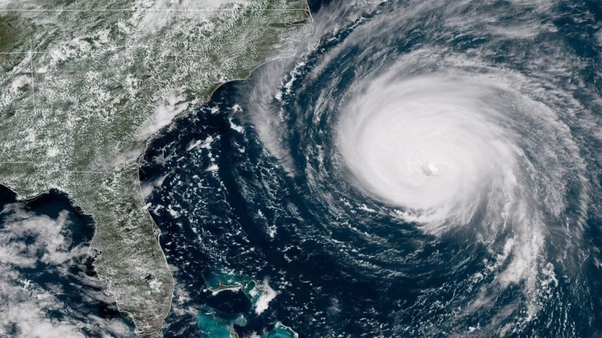
The DMSP satellites capture global imagery from space twice a day, monitoring cloud formations, velocities, compositions and drifts, and provide NOAA with data and imagery.
“Military weather forecasters [using the DMSP] can detect developing patterns of weather and track existing weather phenomena over remote areas, including the presence of fog, severe thunderstorms, dust and sandstorms, and tropical cyclones,” according to the Space Force.
As the Defense Department transfers greater reliance onto the newly fielded Weather System Follow-on Microwave, or WSF-M, use of the decades-old DMSPs for weather monitoring is being rapidly phased out.
The WSF-M, a more modern system that can pinpoint developing weather data more exactly, was declared to have reached Initial Operational Capacity this April. The WSF-M, first launched in 2024, can analyze sea ice, soil moisture and snow depth, as well as measure winds and collect cyclone data.
NOAA will now rely on data and imagery provided by WSF-M as well as the Electro-Optical Weather System, or EWS, to replace the DMSP data, according to its July release.
“DMSP satellites remain operational today but are more than a decade past their expected end of life,” the release said.
The move comes as the Trump administration has signaled its opposition to policies aimed at addressing climate change. Earlier this year, the U.S. Coast Guard Academy removed references to “climate change” and related terminology in an effort to follow President Donald Trump’s policies.
While DMSP data is not available, NOAA has not lost all access to global weather imaging, as it still retains its access to data gathered from its Joint Polar Satellite System as well as from buoys, other observation satellites and ground-based weather radar sites in the U.S. and globally.
“While the discontinuation of certain data streams from DMSP may seem alarming, the transition to WSF-M and EWS represents a modernization effort aimed at providing more resilient and enhanced environmental monitoring capabilities to improve our ability to understand and predict weather phenomena, including tropical cyclones,” NOAA said.
Even as the Navy is under pressure to modernize existing systems and infrastructure, the space domain is facing similar challenges, albeit on a different scale. Last fall, the Government Accountability Office reported that the Space Force has been struggling to modernize its GPS capabilities, citing deficient equipment as a contributing factor.
The Army is currently overhauling its network capabilities, and in an effort to replace outdated satellite infrastructure earlier this March, installed satellite communications systems at a new teleport facility in Okinawa, which is expected to be fully operational by November.
Additionally, the DOD this month is reported to have awarded a $28.4 million contract to L3Harris Technologies to enhance the Navy’s satellite communications capabilities.
Zita Ballinger Fletcher previously served as editor of Military History Quarterly and Vietnam magazines and as the historian of the U.S. Drug Enforcement Administration. She holds an M.A. with distinction in military history.
Read the full article here